


Russ Schumacher provides context for Hurricane Ida’s record-breaking rainfall
Colorado State Climatologist and Professor Russ Schumacher wrote this piece for The Conversation. Colorado State University is a contributing institution to The Conversation, an independent collaboration between editors and academics that provides informed news analysis and commentary to the general public.
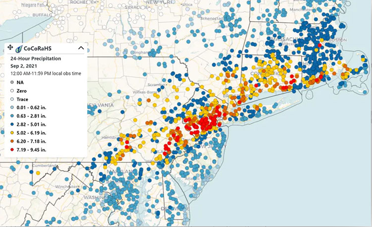
Record downpours from Hurricane Ida overwhelmed cities across the Northeast on Sept. 1, 2021, hitting some with more than 3 inches of rain an hour. Water poured into subway stations in New York City, and streets flooded up to the rooftops of cars in Philadelphia. The storm had already wreaked havoc on the Gulf Coast after hitting Louisiana three days earlier as a Category 4 hurricane.
Ida had weakened well below hurricane strength by the time it reached the Northeast, so how did it still cause so much rain?
Two major factors likely contributed to its extended extreme rainfall.
First, Ida’s tropical moisture interacted with developing warm and cold fronts.
Second, evidence is mounting that, as the climate warms, the amount of precipitation from heavy rainstorms is increasing, especially in the central and eastern U.S.
Read the full article, “Hurricane Ida: 2 reasons for its record-shattering rainfall in NYC and the Northeast long after the winds weakened.”
Image at top: Rainfall totals over 24 hours, Sept. 1-2, 2021. CoCoRaHS Mapping System